The St. Louis Preservation Crew is an IRS approved 501(c)(3) nonprofit organization. Your donation may qualify for tax benefits. Please consult your tax advisor.


GO BACK &
GET IT

SAVING WASHINGTON PARK
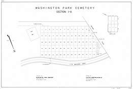
Washington Park Cemetery Maps
Original maps were created in 1920, serving as essential tools for navigation and sales. The original site spanned 75 acres, with 17 sections that included over 56,000 interments.
In the 1950s, Interstate 70 was constructed through the cemetery, seperating Sections 13-17 and paving over the graves in Sections 12-14. In 1983 several acres along the highway were purchased by DDI Media (Drury Hotels) who installed 3 two-sided billboards among the burials in Sections 10, 12 & 14 and paved an access road through Section 13.


Section Maps
Between 1963 and 1979, updated maps and surveys were created to reflect the cemetery's expansion, changes to roads and pathways, and to provide more accurate information for visitors and staff. As roads were narrowed to make room for more burials, these new sections were labeled with letters. The appropriate map for locating family members will depend on their burial year.
This ongoing process of updating maps highlights the importance of keeping geographical data current to meet the needs of families. Hi-Resolution images are available by request or by visiting the St. Louis City Recorder of Deeds.
*All Maps and Records for Section 13 have mysteriously disappeared.